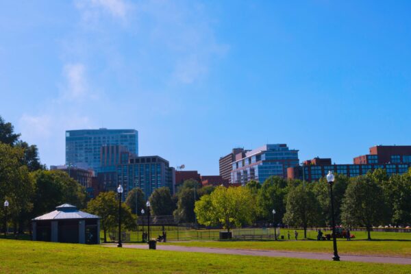
Monroe Park is one of the oldest and most historically significant public parks in Richmond, Virginia. Located near Belvidere Street and Franklin Street, the park combines open lawns, pathways, a fountain plaza, a pavilion, and memorial features within a central urban setting. Its importance lies in how the landscape reflects several stages of Richmond’s development, from early estates and transportation routes to civic projects and modern restoration.
The park is also notable for several recognizable landmarks. The current fountain was installed in 1906, the Checkers House dates from 1939, and a pavilion was added during the 2018 restoration. Together, these features make Monroe Park a practical public space and a visible record of the city’s changing history.
Quick Facts About Monroe Park
- Monroe Park is located in Richmond, Virginia, near Belvidere Street and Franklin Street.
- It is one of Richmond’s oldest public parks.
- The current fountain was installed in 1906.
- The Checkers House was added in 1939.
- A pavilion was introduced during the 2018 restoration.
- The park contains the Richmond World War II Monument, designed in 1951.
Early Development
Before Monroe Park became a formal public space, the surrounding land was associated with Belvidere, a large property owned by William Byrd III during the eighteenth century. Byrd built a country house there in 1758, and the house and gardens remained until they were destroyed by fire in 1854.
The surrounding neighborhoods also developed through early subdivisions. In 1817, the Harvie family created a rural subdivision known as Belvidera, which later became associated with Oregon Hill. Between 1816 and 1819, the family also laid out Sydney, a larger subdivision that shaped many of the streets and blocks now found in the Fan neighborhood.
Scuffletown and Park Avenue
The history of Monroe Park is connected with Scuffletown, a small settlement that developed during the late eighteenth century near present-day Park Avenue and Strawberry Street. The settlement stood along an early road used to transport coal from Henrico’s Deep Run pits.
The name referred to a 1781 skirmish involving the Virginia Militia and British soldiers led by Benedict Arnold. The route remains visible today because Park Avenue begins at Monroe Park and follows the alignment of the former Scuffletown Road. This street pattern also contributed to the wedge-shaped layout of the Fan neighborhood and the formation of several triangular blocks.
Public use of the land expanded during the middle of the nineteenth century. The Virginia State Agricultural Society was organized in 1850 to establish an annual agricultural fair, and in 1853, it worked with the city to develop Western Square, the former name of Monroe Park, as the fairground.
The location was suitable because it was large, open, relatively flat, and accessible from major roads and railway connections. The success of the event led to a national agricultural fair at the same site in 1858. After approximately five years, the fair moved to a larger location, while the former fairgrounds were later used for military purposes during the Civil War.
Streets and Civic Infrastructure
The streets surrounding Monroe Park preserve several elements of Richmond’s early planning. Laurel Street forms the western boundary of the park and appears on an 1817 map alongside other streets named after trees. Its northern section follows the downtown grid, while the southern section aligns with Oregon Hill.
A signal station for police and fire alarms was added near Belvidere Street and Franklin Street in 1923. The Classical Revival building remained until the 1970s, when it was demolished during the widening of Belvidere Street. This project reduced the size of the park and created the curved eastern edge visible today.
Fountain Plaza and Checkers House
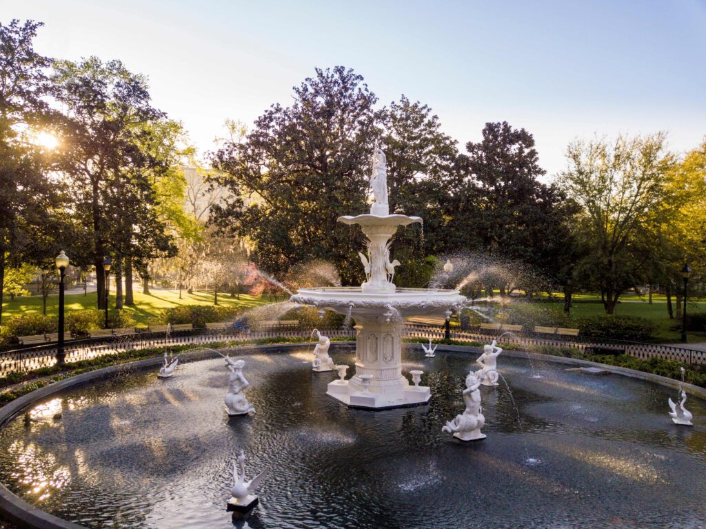
The fountain plaza remains one of the defining elements of Monroe Park. The first fountain was installed in 1871 and consisted of a rock pyramid with flowing water. The current tiered fountain replaced it in 1906, introducing a more formal design.
The Checkers House also reflects the park’s role as a community space. A Keeper’s Lodge was first constructed around 1890 to provide visitor facilities and work space for park maintenance. A replacement structure was added in 1939 and became known as the Checkers House because visitors regularly played checkers there. The 2018 restoration introduced an accessible plaza and additional seating around the building.
Memorials and Modern Use
Monroe Park contains several memorial features connected with Richmond’s history. The Richmond World War II Monument, designed by landscape architect Charles Gillette in 1951, includes the names of local residents who died during the war. The park also contains a plaque dedicated to George Washington and the McGuire Bench, which recognizes a school that operated nearby from 1866 until 1940.
Three other monuments were removed in June 2020: the Wickham Statue, the Lee Cross, and the Bryan Statue. Their removal changed the park’s visual composition while leaving other historical features in place.
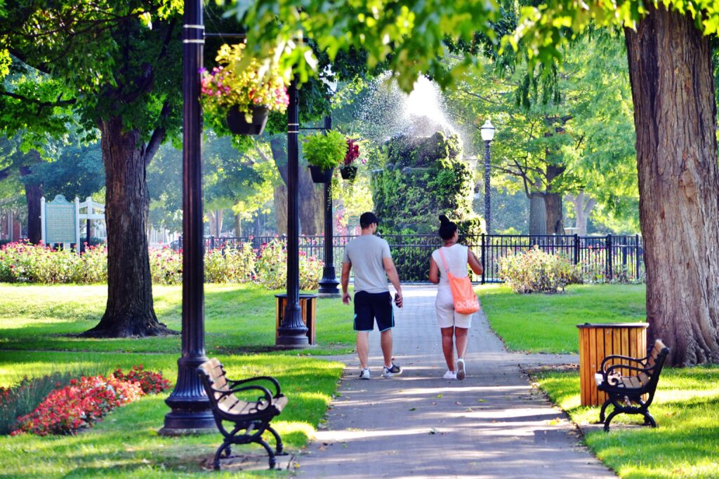
Monroe Park remains an important part of Richmond because it combines recreation, civic memory, and urban continuity. Its lawns, fountain, pavilion, pathways, and memorials allow the park to serve as both a functional green space and a record of the city’s development.
Comments are closed